.avif)


Wyoming’s majestic Teton Mountains are the centerpiece of Grand Teton National Park. The towering Grand Teton, standing at nearly 14,000 feet (4,200 meters), rises above a scene rich with extraordinary wildlife, shimmering alpine lakes, and lush meadows. With over 200 miles (320 kilometers) of hiking trails, ranging from easy day hikes to overnight backcountry excursions, hikers will find plenty of opportunities to explore the spectacular scenery of Grand Teton National Park.
Many of the famous sights in Grand Teton National Park can be experienced by driving the scenic road through the park. However, in our opinion, the best way to experience the park is by lacing up your hiking boots and hitting the trails. With so many hiking trails to choose from, we’ve gone ahead and identified the top hikes in Grand Teton National Park.

When to Visit Grand Teton National Park
During the months of mid-May to late September, all visitor centers, hiking trails, and other activities, including kayaking and fishing, are open and accessible. The summer months will have additional crowds, but Grand Teton National Park does not see that same amount of visitors as its neighbor, Yellowstone National Park. So even during the peak season, you will be able to find some solitude, especially on the backcountry hiking trails.
Spring (March through May)
Spring is the second busiest season for tourism even though rain is somewhat common. High temperatures average in the mid-60s Fahrenheit (18 Celsius) and lows can drop to 30 Fahrenheit (-1 Celsius). Expect most hiking trails to be covered in snow, especially in the higher elevations.
Summer (June through August)
This is the peak of the tourist season and reservations are recommended for all lodging, though most campgrounds work on a first-come, first-served basis. Due to the high elevations, the evenings still experience cooler weather, and daytime temperatures are comfortable. These months experience the least precipitation through afternoon thunderstorms are common.
Fall (September through November)
Even with the beautiful fall foliage that can be experienced in the Grand Tetons, tourism drops off significantly during these months, making it a nice time to visit if you are looking for quiet, peaceful hikes. Daily temperatures reach the mid-70s Fahrenheit (23 Celsius) and can drop to 32 Fahrenheit (0 Celsius). It can rain and snow a significant amount during these months.
Winter (December through February)
The weather can be pretty brutal this time of year with heavy snowfall and below-freezing temperatures. These months experience the lowest levels of visitors but that is not to say extreme adventurers do not visit the park. A few facilities do stay open and visiting during the winter will offer visitors a unique perspective into the landscape of the park.
Come explore Grand Teton and Yellowstone National Parks with like-minded travelers on an Under30Experiences group trip.
Now that we’ve outlined some of the details of each season, here is our list of top hikes in Grand Teton National Park.
Sting Lake Loop
- Difficulty: Easy
- Distance: 3.8 miles (6.1 kilometers) loop
A fairly gentle hike that offers incredible views, the String Lake Loop is a perfect trail for visitors who want to combine hiking and some fun on the water.
Beginning at the Spring Lake Trailhead, located just north of Jenny Lake, hikers can choose to hike this loop clockwise or counterclockwise. If you are hiking in the morning, it is recommended to hike counterclockwise to enjoy the views of the mountains over the lake.
Heading north along the eastern section of String Lake, hikers will immediately be rewarded with amazing views of the Cathedral Group. The Cathedral Group consists of three peaks all over 12,000 feet (3,600 meters). At just over a half-mile (0.8 kilometers), the trail passes the Leigh Lake Trailhead. Continue straight at this junction keeping to the eastern shore of the lake. Views of the 12,605-foot (3,842 meters) Mt. Moran, the fourth highest mountain in Grand Teton National Park, will become more apparent.
At around 1 mile (1.6 kilometers) the String Lake Horse Trail forks off to the right. Be sure to stay on the main String Lake Loop trail by continuing straight at this junction. After crossing over the Leigh Lake Outlet, around 1.5 miles (2.4 kilometers) into the hike, turn left at the junction and cross over the footbridge. After crossing the footbridge, the trail travels away from the lake and begins a moderate climb through a lodgepole pine forest.
At just over 2 miles (3.2 kilometers), the trail reaches the Paintbrush Canyon Trail junction. Continue straight at this junction, staying on the main trail, and soon the trail will begin to descend toward the lake. This section of the trail has multiple open areas that provide great views of String Lake. At around 3.5 miles (5.6 kilometers) the trail comes to the junction of the Jenny Lake Trail. Turn left at this junction and continue hiking until you reach the footbridge that crosses over the String Lake Outlet.
Cross over the footbridge and turn left to return back to the trailhead.
Note: This is a very popular hike. It is recommended to hike early in the morning to avoid crowds and to see incredible views of the 5etons reflecting off the lake.
Read our Tent Buying Guide before purchasing that new tent.
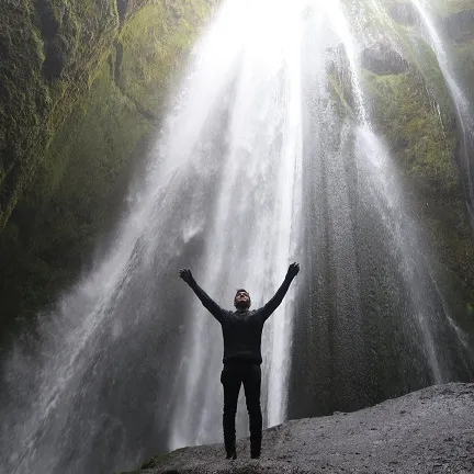
Hidden Falls and Inspiration Point
- Difficulty: Easy
- Distance: 5 miles (8 kilometers) or 2.6 miles (4 kilometers) if you take the shuttle boat
One of the most popular and scenic hikes in Grand Teton National Park, Hidden Falls is located just past the shores of Jenny Lake. This hike is combined with a shuttle boat that crosses Jenny Lake, making the hike more manageable.
Begin by taking the shuttle boat across Jenny Lake to the Cascade Canyon Trailhead. After getting off at the boat dock, the trail climbs a gentle gradient along a rocky path through a conifer forest. The trail crosses several footbridges over the Cascade Canyon Creek. At just over a half-mile (0.8 kilometers), hikers will reach the horse trail leading up from Jenny Lake. Continue straight at this junction, eventually coming to another bridge that spans the river below the falls. Just before the bridge is a small spur trail that offers incredible views of Hidden Falls, which stands at roughly 100 feet (30 meters).
After viewing the waterfall, return to the main trail and cross the bridge that crosses over the creek. This trail leads up to Inspiration Point. This half-mile (0.8 kilometers) section of the trail is steep, so take your time hiking up. Along the way, you will be rewarded with views of the 12,325 foot (3,756 meters) Teewinot Mountain and panoramic views of Jenny Lake from the top.
Note: The boat shuttle runs every 15 minutes and costs $18/adult and $10/children.

Phelps Lake Overlook
- Difficulty: Easy
- Distance: 2.4 miles (3.8 kilometers) round trip
Nestled within a backdrop of snow-capped peaks, Phelps Lake is a must-visit destination when visiting Grand Teton National Park. Though easily accessible, this hike still offers the quietness of the backcountry and a great place to take a swim in the cold, refreshing glacial waters.
The trail starts at the Death Canyon Trailhead. This trailhead is located down Whitegrass Ranch Road about 3 miles (4.8 kilometers) south of Moose Junction. Only part of Whitegrass Road is paved and a 4x4 vehicle is recommended to drive all the way to the official trailhead. However, you will find a parking lot at the end of the paved section and from there you can walk a little under a mile (1.6 kilometers) to the Death Canyon Trailhead.
Immediately from the start of the hike, you will begin a gradual climb going uphill. Turn left at the junction with the Valley Trail to continue towards the Phelps Lake Overlook. At roughly 1.2 miles (1.9 kilometers) from the trailhead, hikers will reach the overlook. From this viewpoint, you are at an elevation of 7,200 feet (2,194 meters). Enjoy the panoramic views from the vantage point as you look down on Phelps Lake, the sixth largest lake in the park.
You can choose to turn around and return to the trailhead after taking in the views. But if you want to continue heading down to the lake for a swim, simply follow the trail for another 1.4 miles (2.2 kilometers). This section of the trail begins by descending a series of steep switchbacks, which you will have to hike back up after your swim.
After coming down the trail from the Phelps Lake Overlook, the trail will level out along a sandy shore on the northern banks of Phelps Lake. Here you will find a few backcountry camping sites. If you want to camp here you will need to apply for a backcountry camping permit from a ranger’s station before beginning the hike.
Note: The Valley Trail will continue heading west once you arrive at the lake. However, there is a small spur trail leading to the east that meanders through the forest and wraps around the banks of the lake to a granite rock outcropping. Referred to as “Jumping Rock'' by the locals, this one of the best natural rock jumps in the park.
Explore hiking trails in Yosemite, Bryce Canyon, and Great Smoky Mountains national parks.
Signal Mountain Trail
- Difficulty: Moderate
- Distance: 6.8 miles (10.9 kilometers)
A hike up to Signal Mountain is a great way to take in the views of Jackson Lake and the Grand Tetons without going too deep into the backcountry. Yes, you can actually drive up to the summit but the hike is much more rewarding.
The hike begins at the parking lot of the Signal Mountain Lodge, which also has a campground making this a great hike for those camping in the area. Begin by taking the paved path located east of the campground registration area and crossing over the Teton Park Road.
After crossing the road, the trail begins a steep climb up Signal Mountain Road. After about a half-mile (0.8 kilometers) the trail passes a lily pond where one may be able to spot a moose. Along the trail, you will begin to see views of Mt. Moran off in the distance. At just under a mile (1.6 kilometers) take the right at the fork of the trail, following the Lake Trail. This is where the loop begins.
Walking along the southern loop, the trail will go past a small lake providing opportunities to spot wildlife. At just over 2 miles (3.2 kilometers), the trail junctions with the other half of the loop. From this point, the trail begins a moderately steep climb passing through forests and grassy meadows. At roughly 3.5 miles (5.6 kilometers), the trail will reach the Jackson Point Overlook. From here you will have great views of the Grand Tetons, Jackson Lake, and the Gros Ventre Mountains.
After taking in the views from Jackson Point Overlook, return down the trail you hiked up. But at the junction of the loop, stay towards the north, following the Ridge Trail, to take in more views of the Grand Tetons on the way back to the parking lot.
Note: Jackson Point Overlook is a great place to watch the sunrise or sunset.
Further Reading: Camping Tips: A Beginner’s Guide to Their First Trip
Hermitage Point
- Difficulty: Moderate
- Distance: 10 miles (16 kilometers) loop
Along the trail, hikers will be offered plenty of opportunities to observe wildlife as the trail passes through meadows and forests making its way to the shores of Jackson Lake. There are also multiple options for small side treks to secluded ponds and viewpoints.
At the Colter Bay Visitor Center, hikers will find the Hermitage Point Trailhead. From the southern end of the parking lot follow the paved path that leads down to the boat landing. Following an old service road around the southern end of the Colter Bay Marina views of Mt. Moran and Rockchuck Peak will be visible towards the west.
Roughly a half-mile (0.8 kilometers) from the start of the trail, veer right at the junction that leads to Heron Pond. Along this section, the trail passes multiple trails that cross the main trail leading to the Heron Pond, including the junction with the Jackson Lake Overlook and at just over a mile (1.6 kilometers) the trail will come to Heron Pond. Heron Pond is a beautiful, little lily-pad covered pond that offers habitat for a variety of waterfowl.
Heading towards the southern shore of Heron Pond, at 1.6 miles (2.5 kilometers), the trail junctions with a spur trail leading to Swan Lake. Turn right to keep on the main trail towards Hermitage Point. As you continue along the edges of Heron Pond you will come to a point that overlooks Half Moon Bay at just under 2 miles (3.2 kilometers).
When the trail reaches the Colter Bay/Hermitage Point split, hikers should turn right leading towards a thick conifer forest. As you proceed further out onto the peninsula, the terrain begins to open up and you will begin to see more views of Jackson Lake and the Tetons. The trail eventually opens up to a sagebrush meadow that offers outstanding views of the Grand Teton Range. Approximately 4.5 miles (7.2 kilometers), the trail will reach the tip of the peninsula and a rocky beach area known as Hermitage Point. From here hikers will have incredible views of the Grand Tetons.
After taking in the views, return to the main trail and follow the path along the southeastern side of the peninsula. After a brief stint through a forested area, the trail returns to a sagebrush meadow environment then comes to the spur trail leading to the Hermitage Point Backcountry Campsite. If you would like to camp here you need to apply for a backcountry camping permit beforehand.
At 6.4 miles (10.2 kilometers), the trail climbs shortly to an overlook of Jackson Lake. A little bit past this overlook, veer to the right at a junction as the trail travels along Third Creek. This section of the trail passes a swampy area overgrown with willows and is popular for moose herds.
At just under 8 miles (12.8 kilometers), hikers should take the trail leading to the left at the junction. From here the trail will begin to gradually climb as it makes its way towards Swan Lake. The trail will come back to the Heron Pond/Swan Lake split again. This time turn right, proceeding towards Swan Lake, located a short distance along the trail. This is another great place to see birds, including Trumpeter swans, the largest native waterfowl species in North America.
Follow the trail along the edge of Swan Lake as it winds through a forested area before returning to the shoreline of the northwestern end of the lake. At just under 10 miles (16 kilometers), the trail comes to another junction. Turn right at this junction and return to the trailhead by following the trail along the south side of the Colter Bay Marina.
Note: Since there are multiple paths throughout this area, it is recommended to obtain a detailed trail map at the visitor’s center before doing this hike.
Death Canyon to Static Peak Divide
- Difficulty: Strenuous
- Distance: 16 miles (25.7 kilometers) round trip
One of the more epic day hikes in Grand Teton National Park, this trail combines the gorgeous Death Canyon with absolutely breathtaking views from the top of Static Peak Divide. Isolated from the more popular parts of the park, you will most likely encounter more moose than other hikers on your day out.
The trail starts at the Death Canyon Trailhead. This trailhead is located down Whitegrass Ranch Road about 3 miles (4.8 kilometers) south of Moose Junction. Only part of Whitegrass Road is paved and a 4x4 vehicle is recommended to drive all the way to the official trailhead, though high clearance SUVs can also make the drive. You will, however, find a parking lot at the end of the paved section and from there you can walk a little under a mile (1.6 kilometers) to the Death Canyon Trailhead.
Immediately from the start of the hike, you will begin a gradual climb going uphill. Turn left at the junction with the Valley Trail to continue towards the Phelps Lake Overlook. At roughly 1.2 miles (1.9 kilometers) from the trailhead, hikers will reach the overlook. From this viewpoint, you are at an elevation of 7,200 feet (2,194 meters). Enjoy the panoramic views from the vantage point as you look down on Phelps Lake, the sixth largest lake in the park.
From the Phelps Lake Overlook, the trail will descend a series of switchbacks towards the lake. After about 1 mile (1.6 kilometers) of downhill hiking, before reaching the lake, turn right at the Death Canyon Trail junction. Once you enter Death Canyon, the trail will begin to climb uphill for the next 2 miles (3.2 kilometers). Sections of the trail through the canyon are rocky with multiple switchbacks as you climb. As you ascend the canyon be sure to look back to take in more incredible views of Phelps Lake.
Your hike through Death Canyon is marked by your arrival to an old Patrol Cabin, nicknamed Death Canyon Barn. At the cabin, you will need to turn right onto the Alaska Basin Trail to begin the climb up to the Static Peak Divide. Over the next four miles (6.4 kilometers), the trail steadily climbs with little to no flat areas. This is by sure the most demanding part of the hike. At about halfway along this climb, views will open up to the east offering a great view of Death Canyon and the Gros Ventre Mountains.
As the trail turns towards the north, the views become better and better as hikers are rewarded with views on both the east and west sides of the park. The trail will still continue its climb, but the views will help keep your mind off your burning quads.
At just over 8 miles (12.8 kilometers) from the trailhead, hikers will reach the Static Peak Divide. From here you will have panoramic views of the entire park. Hikers do have the option to continue on for another half-mile (0.8 kilometers) to the actual summit of Static Peak, though the views from the divide are worthy enough to end here.
Note: This is a challenging hike that can take up to 10 hours or more to complete. This hike should only be attempted by experienced hikers.
Further Reading: Top Hikes in Yellowstone National Park
Paintbrush Canyon to Cascade Loop
- Difficulty: Strenuous
- Distance: 20 miles (32 kilometers) round trip
This massive hike can be an extremely challenging day hike or completed over a 2-3 day backpacking experience. Whatever option you choose, you will be rewarded with an unforgettable experience unlike any other in the Grand Tetons.
The trail begins at the String Lake Trailhead. Hikers will need to cross the bridge over the outlet creek from String Lake. Following signs for the Spring Lake Trail, the trail will begin to gradually climb offering views over String Lake and Leigh Lake. After passing by the lakes, the trail turns to the left and goes through a forest of evergreen trees making its way to Paintbrush Canyon.
As the trail continues into Paintbrush Canyon, you will leave the forest behind and climb several switchbacks as you ascend the canyon. Near the top of the canyon, the trail comes to a fork. Take the left fork at this junction and enjoy the views of the canyon below as you make your way towards Holly Lake, which sits at 9,700 feet (2,956 meters) in elevation. At Holly Lake, you will be approximately 6.5 miles (10.4 kilometers) from the trailhead. After passing Holly Lake, you will notice that the trail begins to get more challenging since you are at a much higher elevation.
As you continue climbing, the trail turns into a rocky, alpine wilderness as it makes its ascent to Paintbrush Divide. Hiking along the rocky trail you will gain incredible vantage points of the jagged mountain peaks surrounding the canyon. It’s important to know that this section of the trail can be very windy and susceptible to thunderstorms. If you notice any inclement weather approaching, it would be best to descend towards the canyon.
Upon reaching the Paintbrush Divide at just over 8 miles (12.8 kilometers) from the trailhead, you will be at an elevation of 10,700 feet (3,261 meters). The views from here are incredible. Take some time to enjoy the views but be mindful that there is still a lot of hiking to do.
The views continue as you hike the 2 miles (3.2 kilometers) down to Lake Solitude. The trail is rocky and rocky through this section so be careful of your footing. Lake Solitude is a beautiful alpine lake and a great spot for a picnic lunch to rest your feet. It is also a popular day hike destination so do not expect to find solitude at Lake Solitude.
From Lake Solitude, the trail follows along the Cascade Creek for a little over 2 miles (3.2 kilometers). Turn left at the junction for the Cascade Canyon Trail and enjoy a nice, gentle downhill walk through the beautiful canyon. Continue following signs for Cascade Canyon as you make your way through forested areas towards Jenny Lake and Cascade Creek. It is common to see moose and the occasional black bear on this section of the trail.
Continuing on the Cascade Canyon Trail will bring you to Inspiration Point, one of the most photographed viewpoints in the Grand Tetons. From Inspiration Point, continue on the trail to see Hidden Falls, a 100-foot cascading waterfall, and another popular location in the park.
Finish your hike by walking along the banks of Jenny Lake until you reach the Spring Lake Trailhead and completing the entire loop.
Note: Snow is known to cover the trail along the Paintbrush Divide through July. Be sure to check current trail conditions at a ranger’s station for the most up-to-date information.

Now that we’ve outlined the must-do hikes when visiting the park, let’s review the essentials to bring along with you when hitting the trails.
Hiking Essentials
- Map: Remember, your smartphone may not have reception at every trailhead. So print out a map of the area and know the important junctions on the trail. Alternatively, ask for a map at the park entrance, or download an offline version of the trail map through an app like AllTrails.
- Water: The amount depends on the climate where you are hiking, but a good rule of thumb is 1 liter (32 ounces) for every two hours of activity.
- Snacks: Always bring a snack, just in case your hike goes longer than planned. Trail mix, granola bars, dried fruit. Keep it nutritious.
- Sun Protection: Apply a layer of sunscreen on your skin before heading out for a hike, even if it’s a cloudy day. Consider wearing a hat or sunglasses to minimize exposure to the sun. You can wear SPF protective clothing as well.
- Headlamp: Whether for an overnight or day hike, bringing along a headlamp is an essential safety must-have. These are small, lightweight devices that fit easily into any bag. You never know when you might need it, and if you do, you’ll be happy to have one.
- Rain gear: Ultralight rain jackets pack down small and can easily fit into your bag. Rainstorms can pop out of nowhere and it’s best to be dry when out in nature.
- First aid kit: Your first aid kit doesn’t need to be big. But make sure you have the basics: bandaids, alcohol wipes, waterproof matches, moleskin, burn treatment, and duct tape.
Okay, now that we’ve got our hiking safety taken care of, head out to explore the top hikes in Grand Teton National Park.
Want to learn more about other national parks? Check out these articles:
- Top 6 Reasons to put Joshua Tree National Park on your United States Bucket List
- Top Reasons to Put Zion National Park on your United States Bucket List
- Visitor Guide to Great Smoky Mountains National Park
- Top 5 Reasons to Visit Acadia National Park
For more great travel guides and all of our best content make sure you are signed up to our travel blog newsletter.